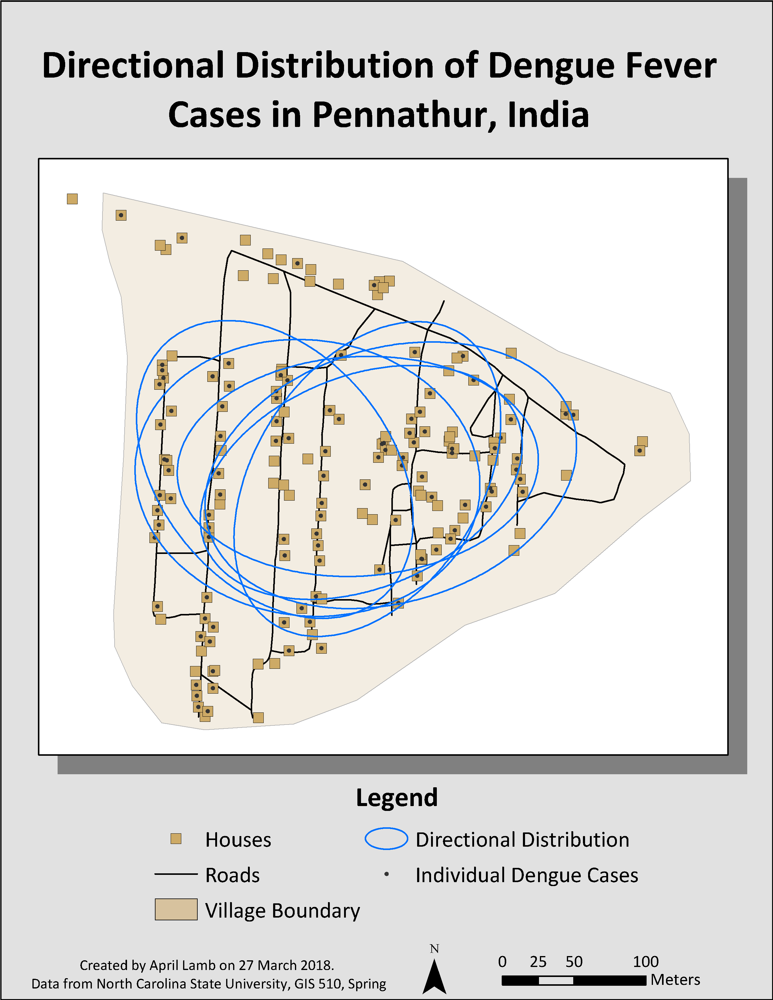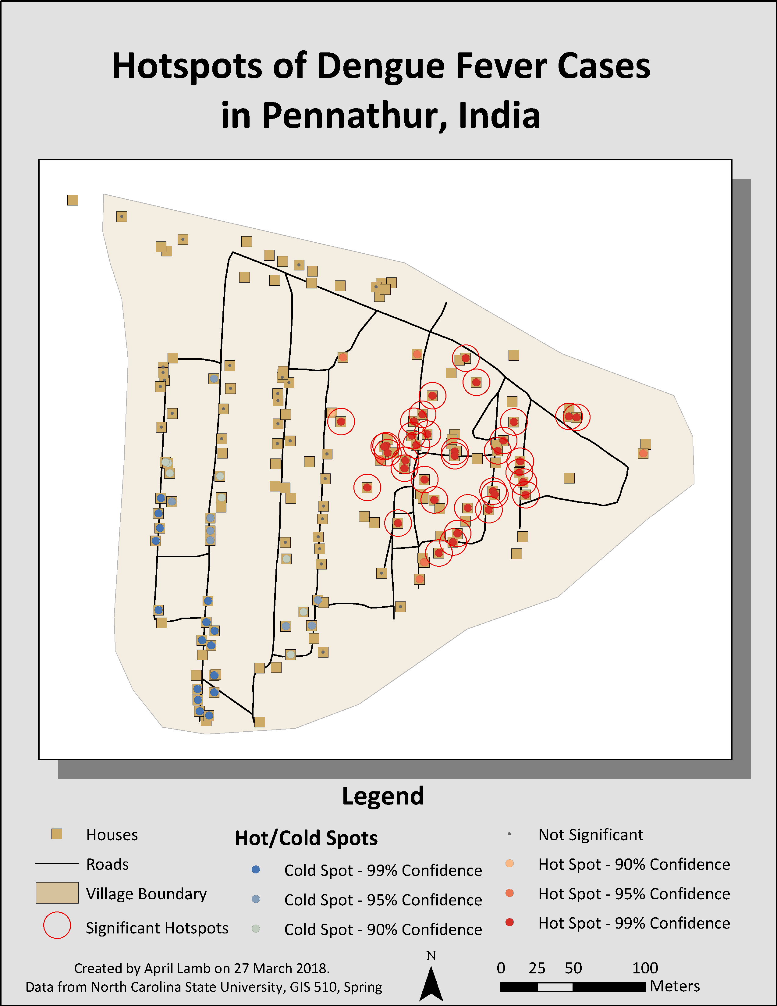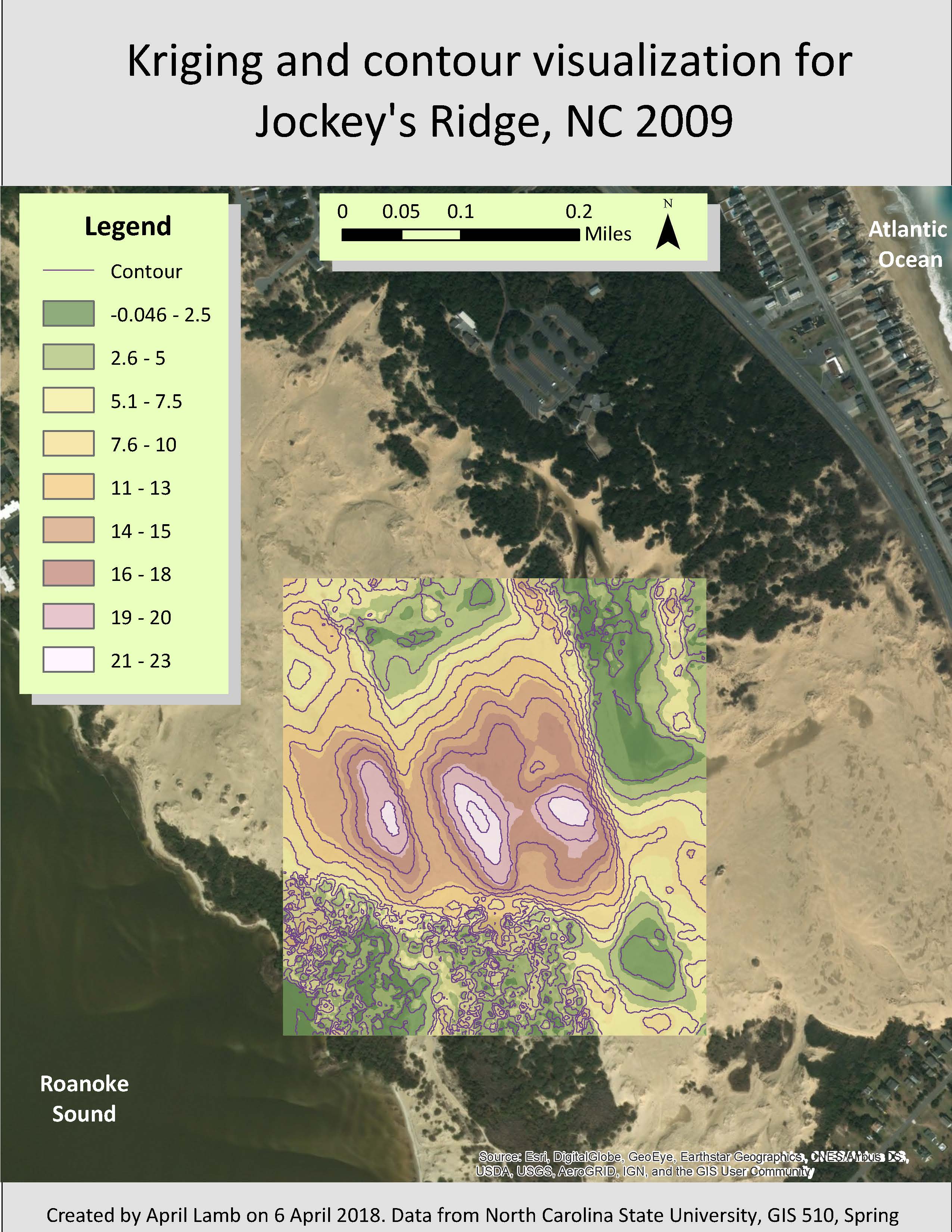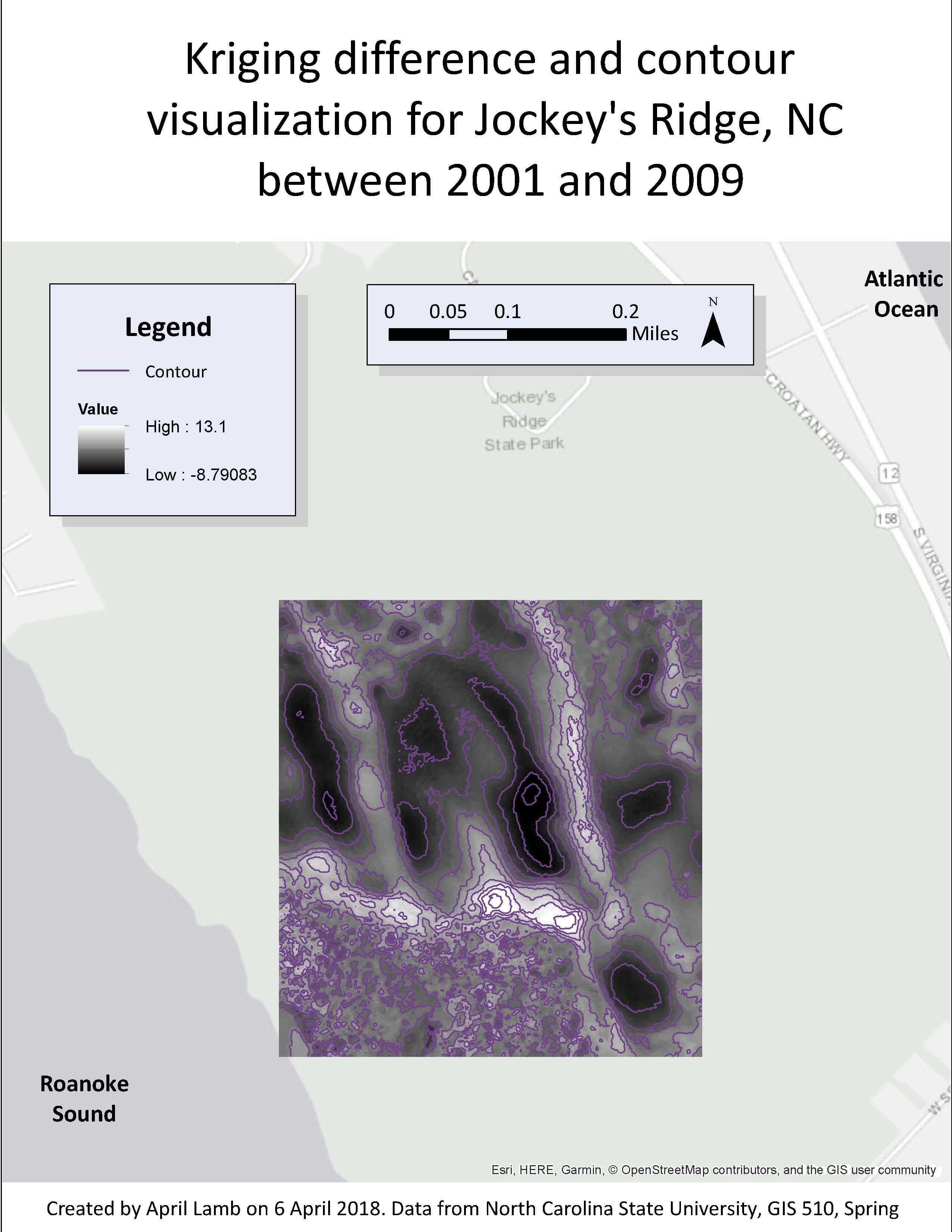
GIS Portfolio
This page houses a selection of maps created using ArcGIS. This work was done primarily to satisfy the criteria NC State's Graduate Certificate in Geographic Information Systems , but other non-certificate related works are also included. This page is a work in progress and content will be added as I find time.
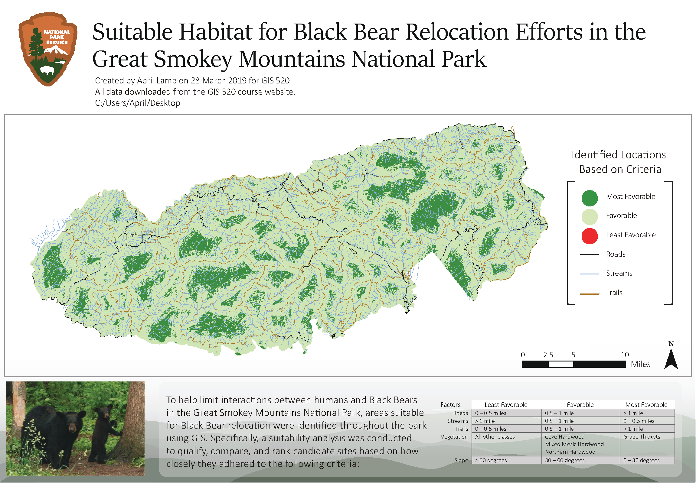
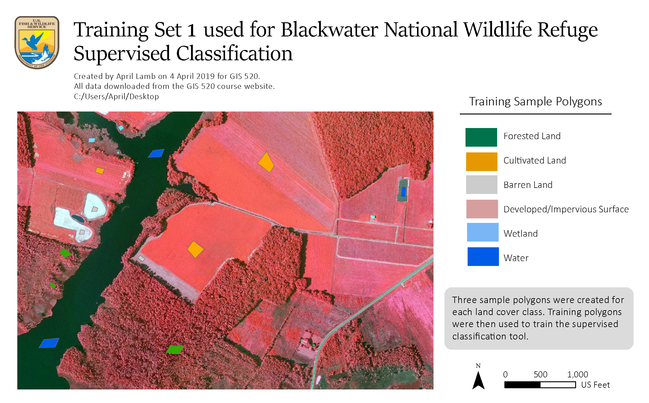
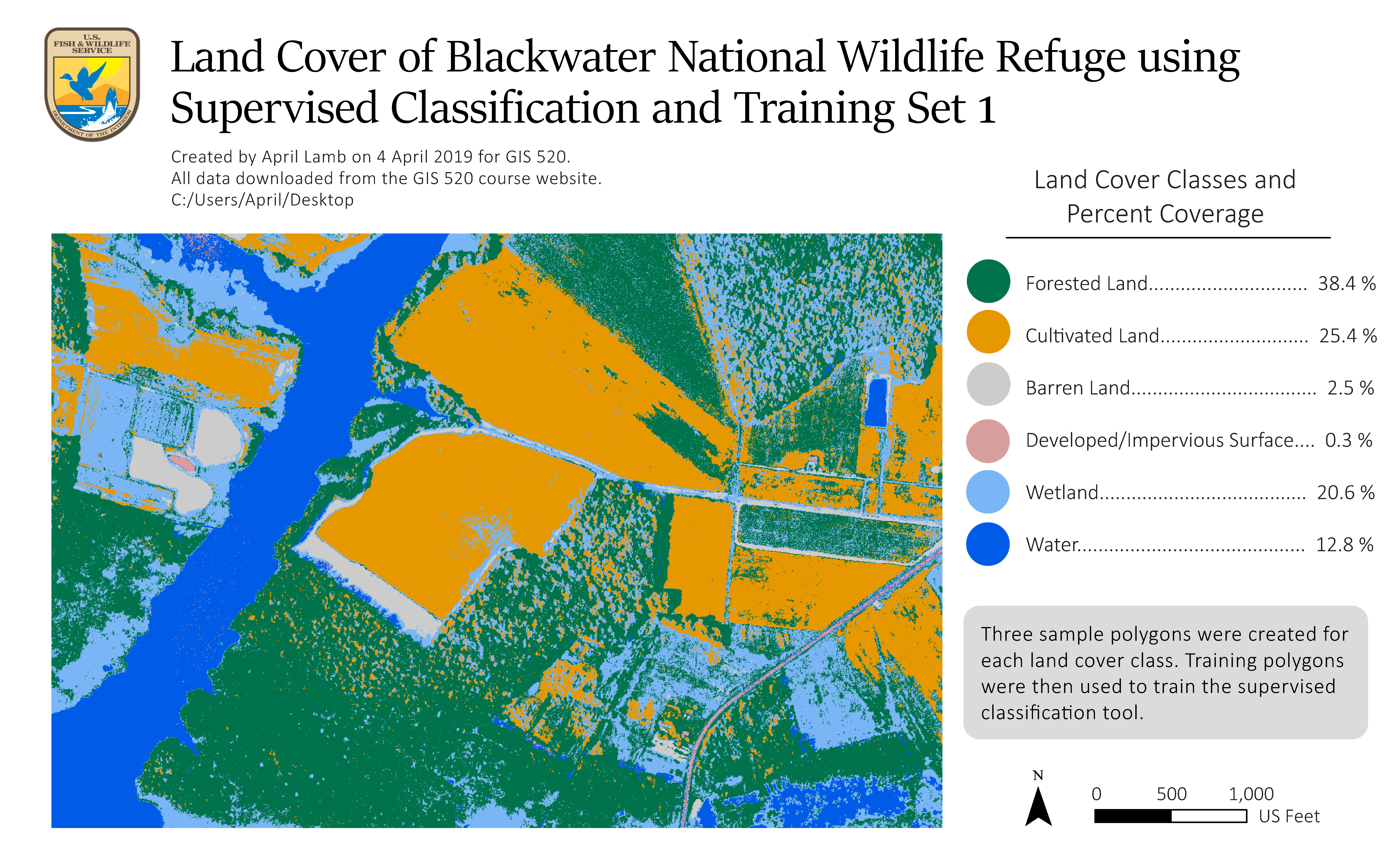
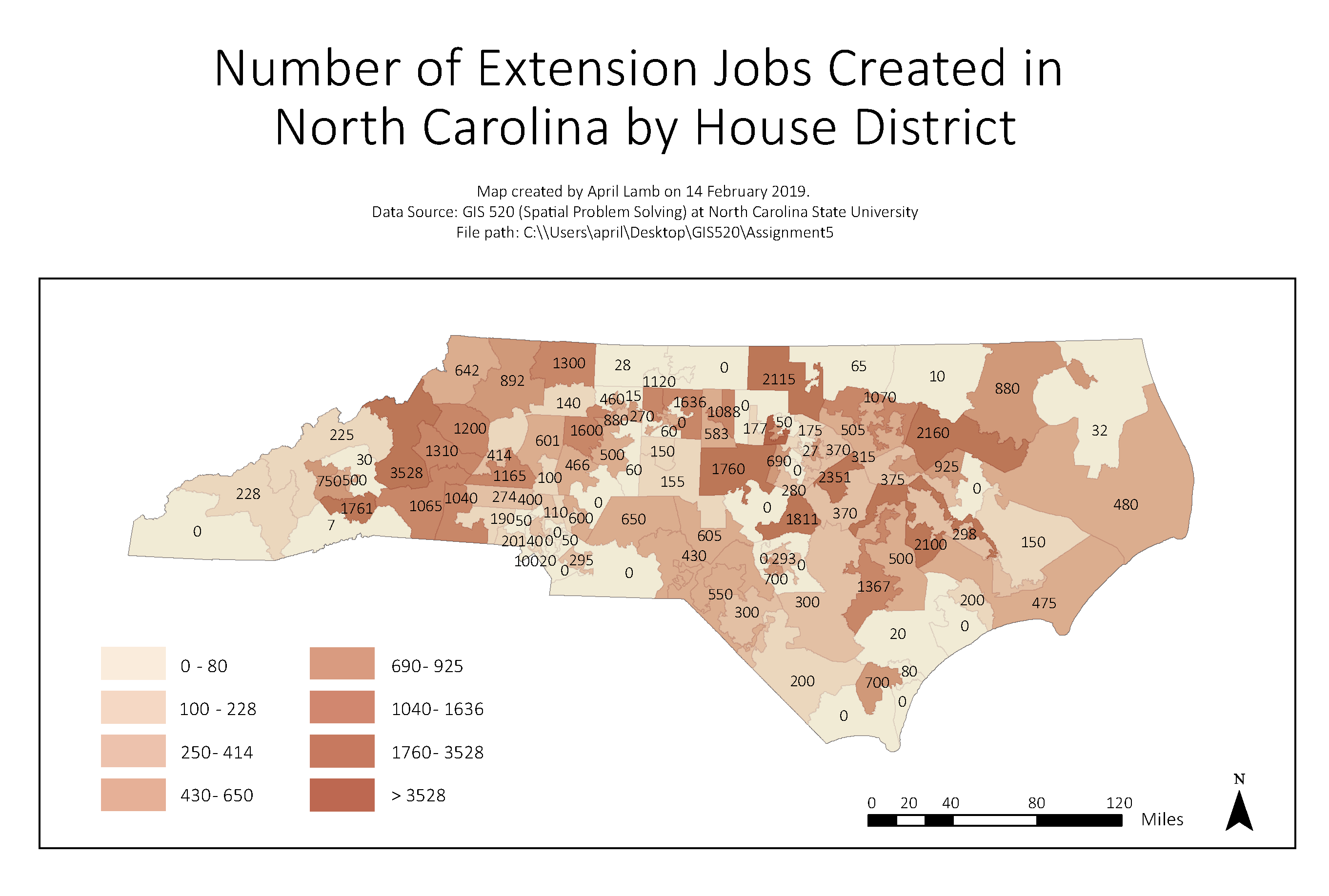
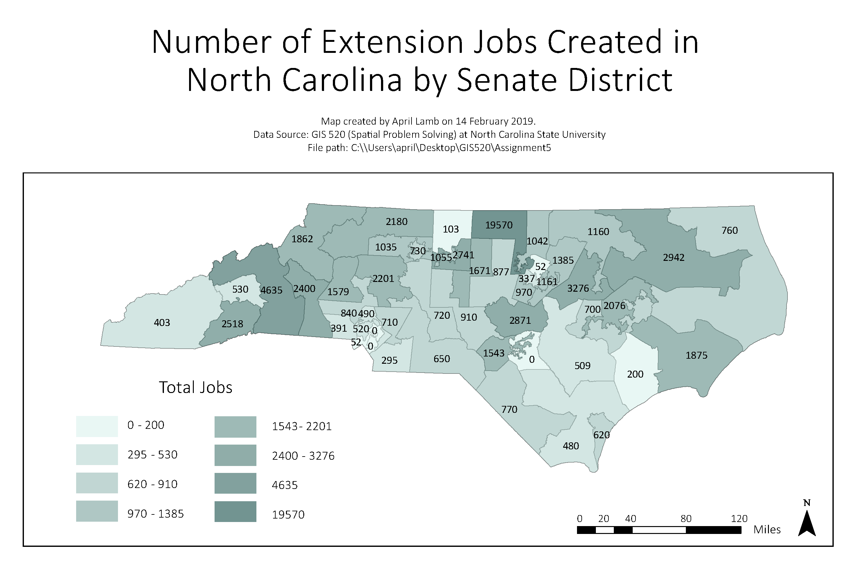
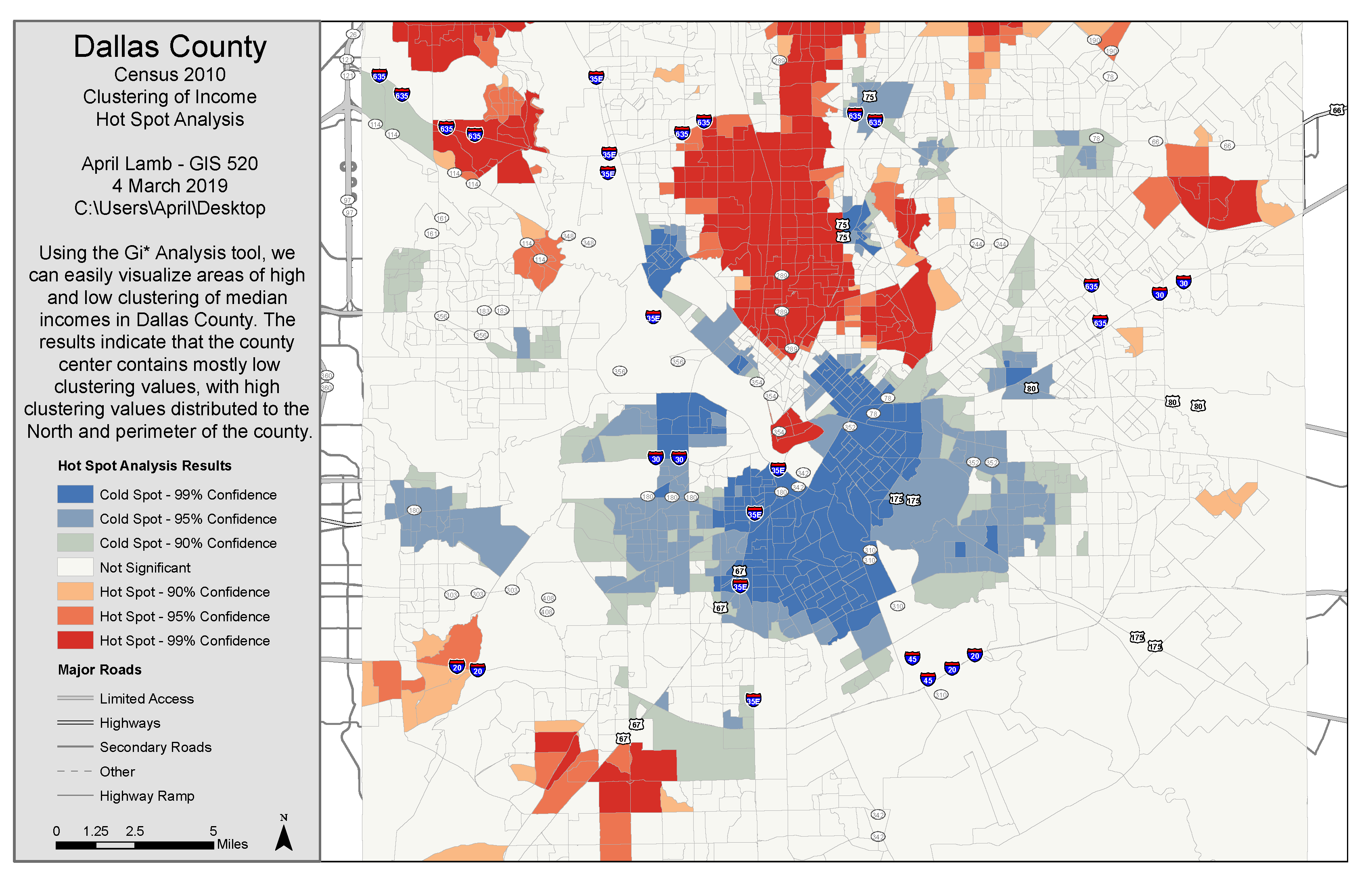
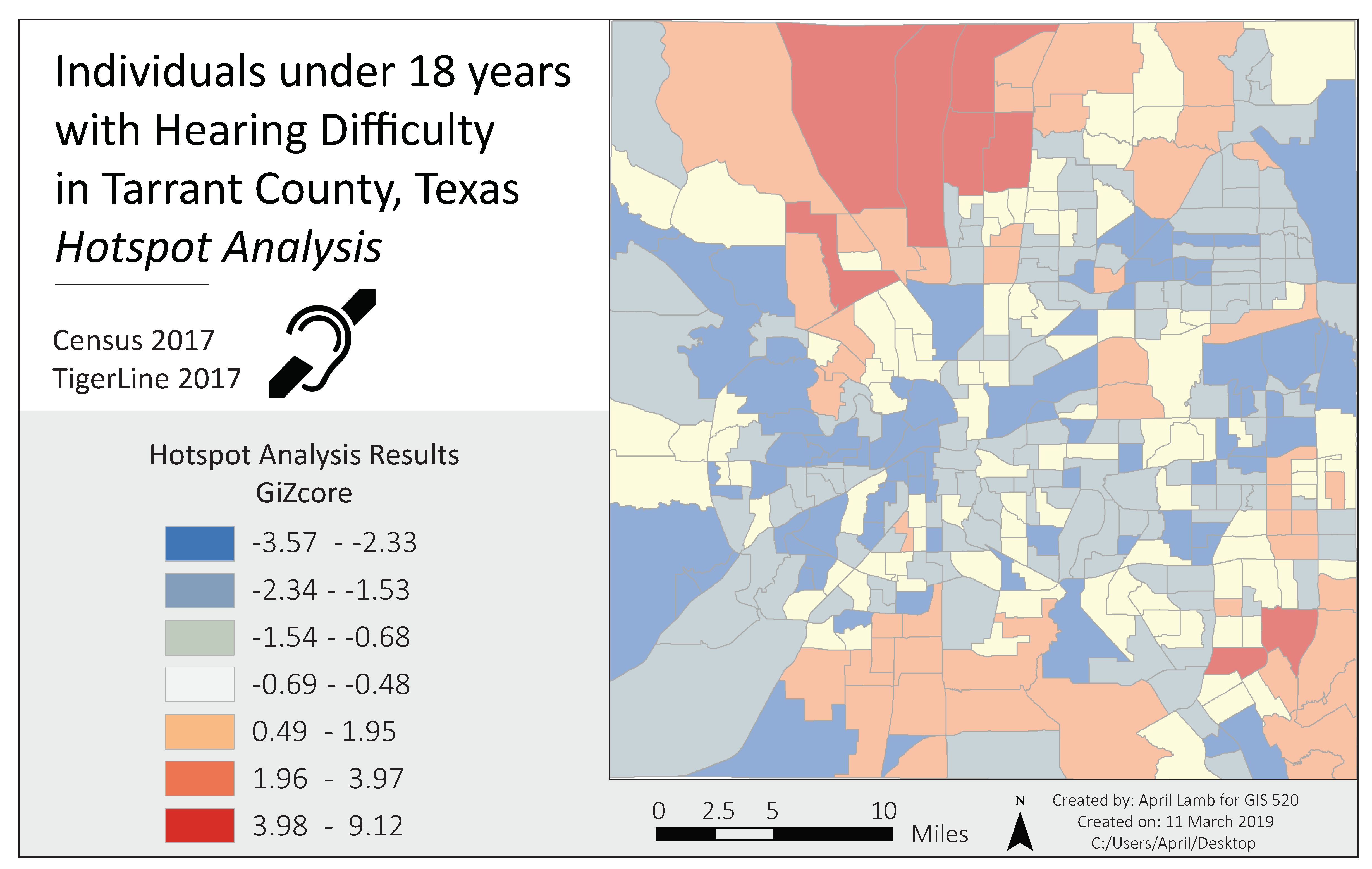
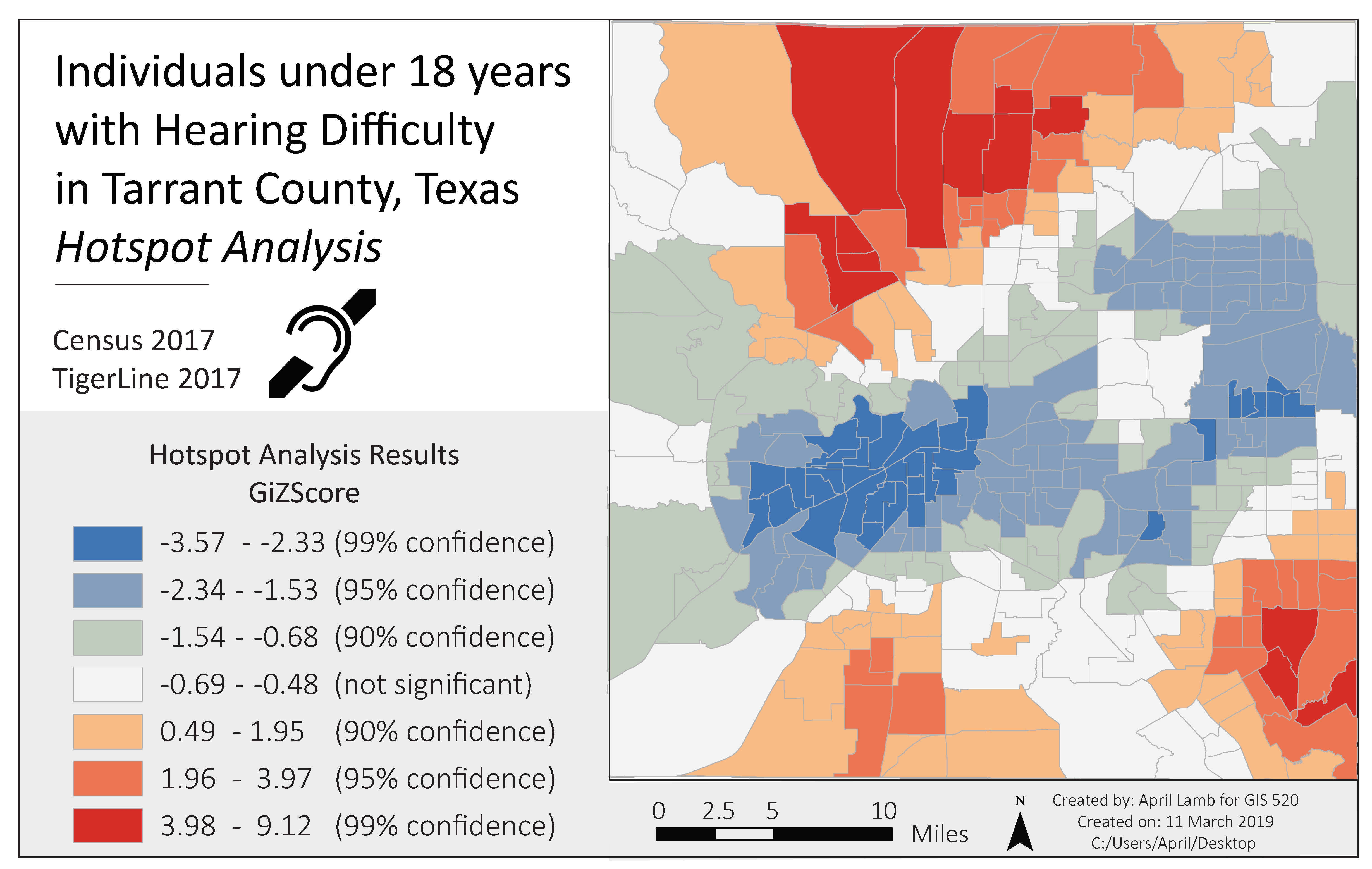
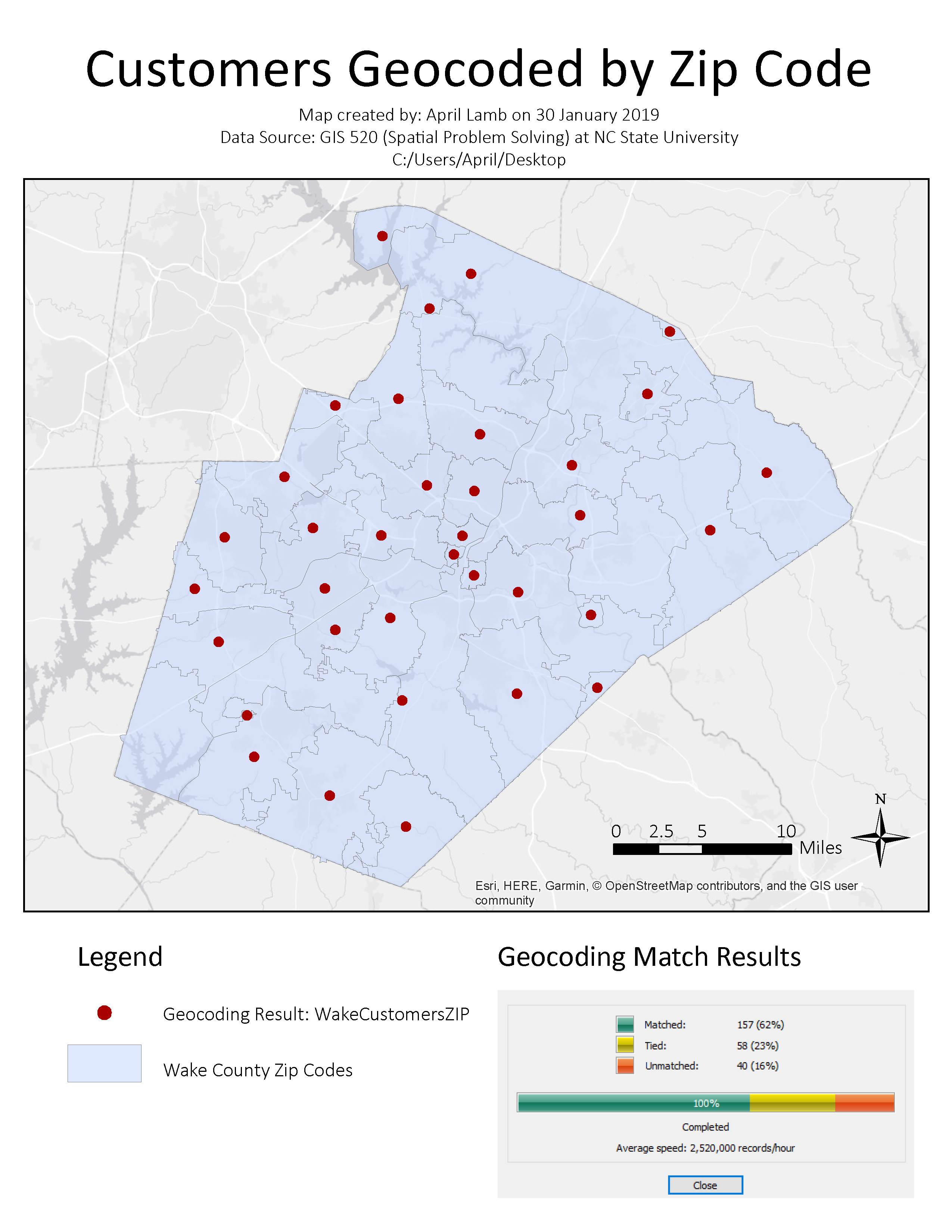
GIS 520: Spatial Problem Solving
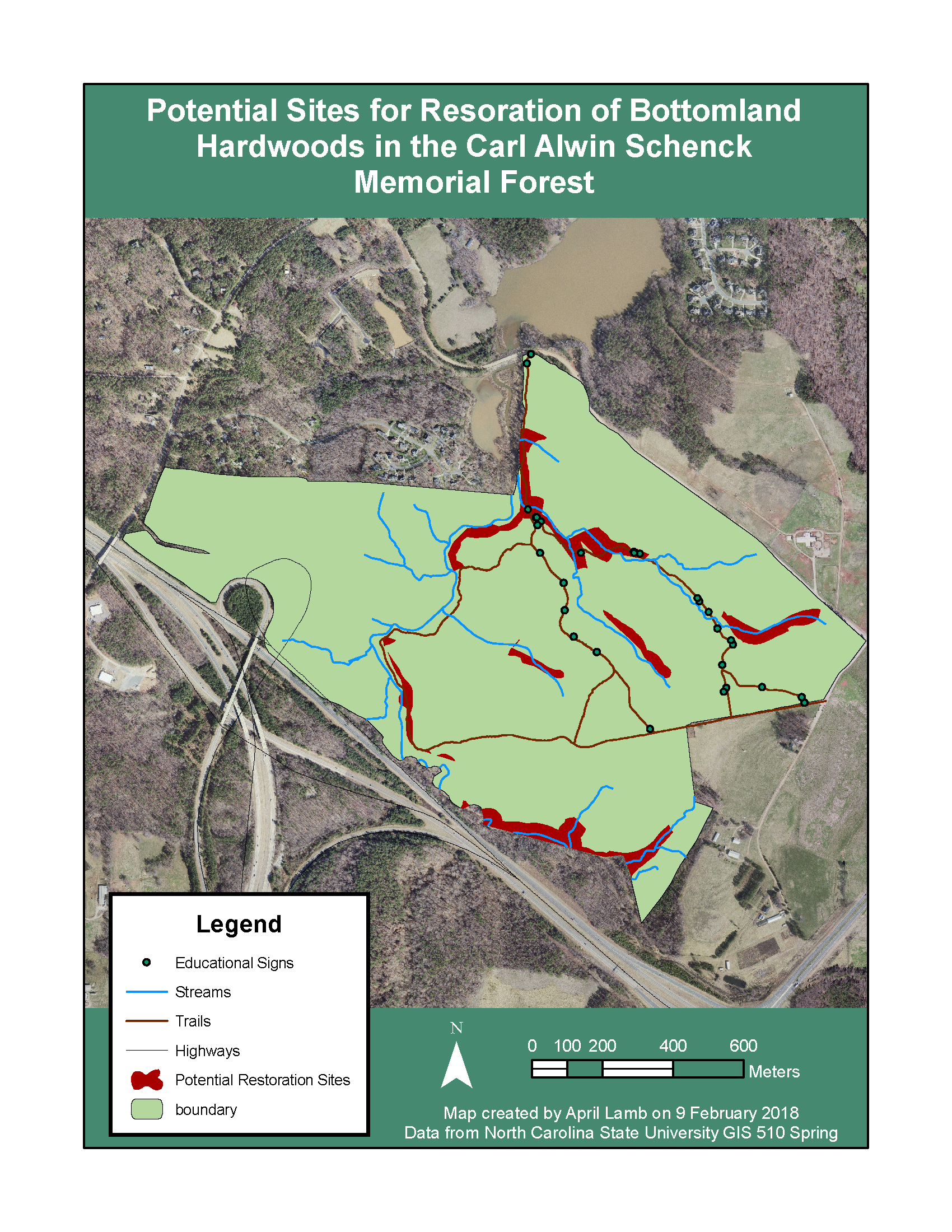
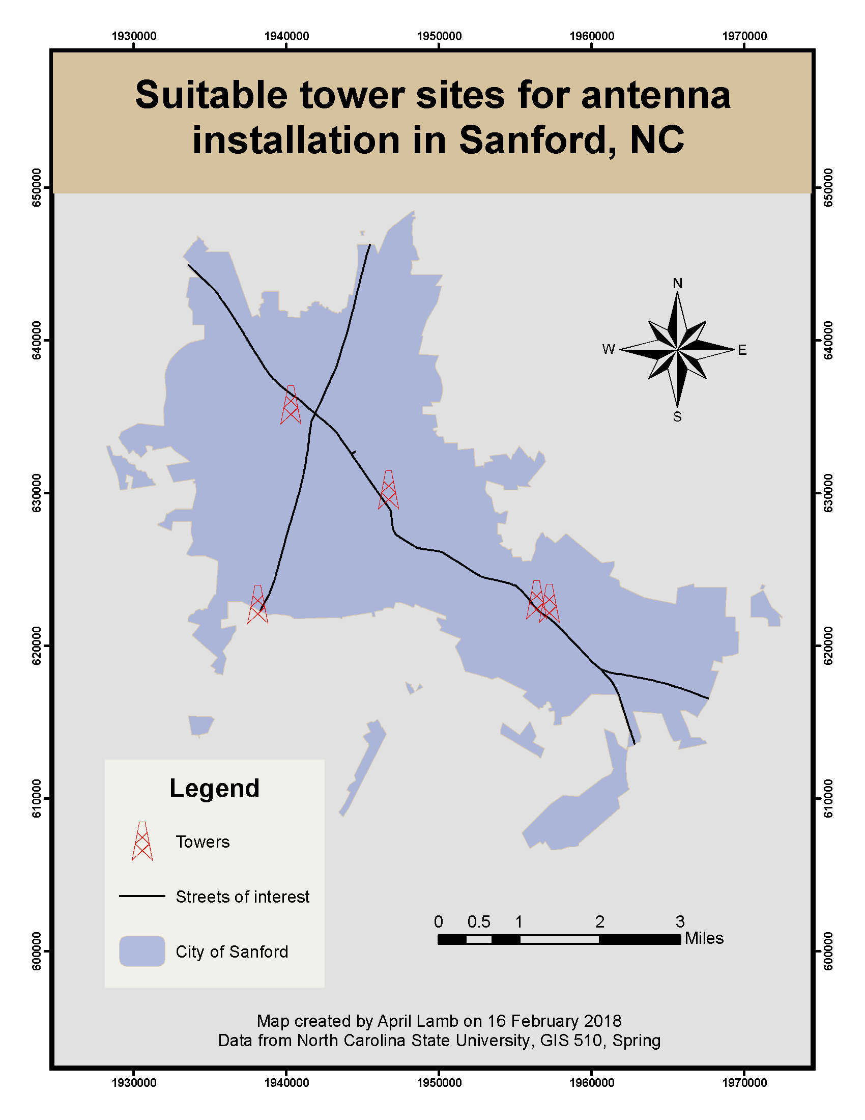
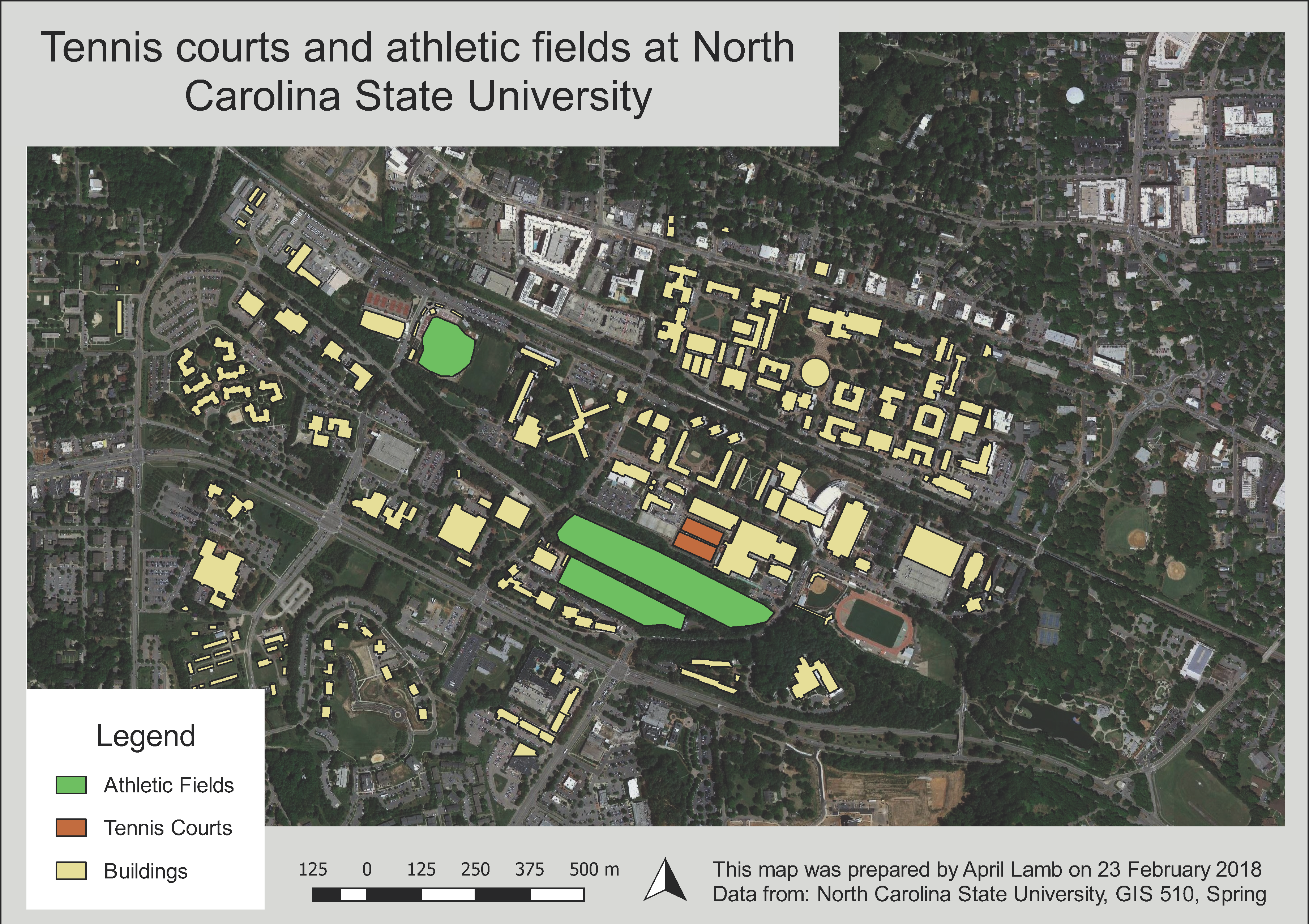
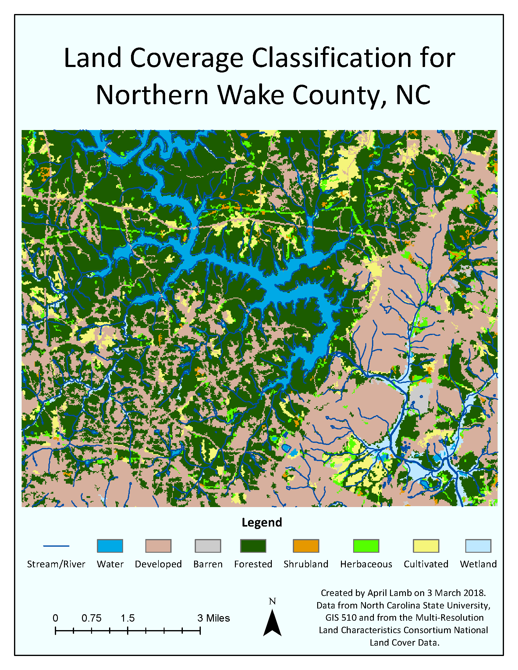
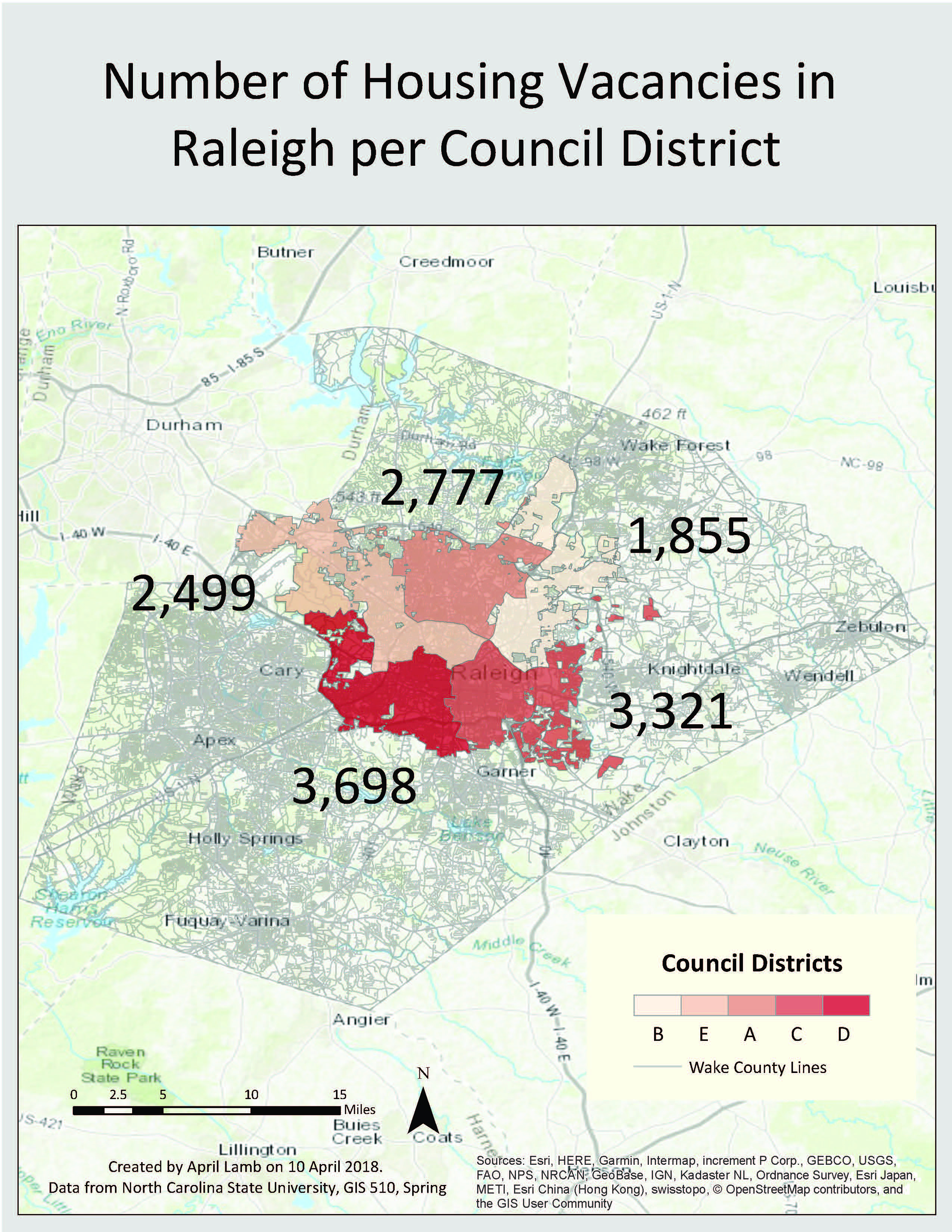
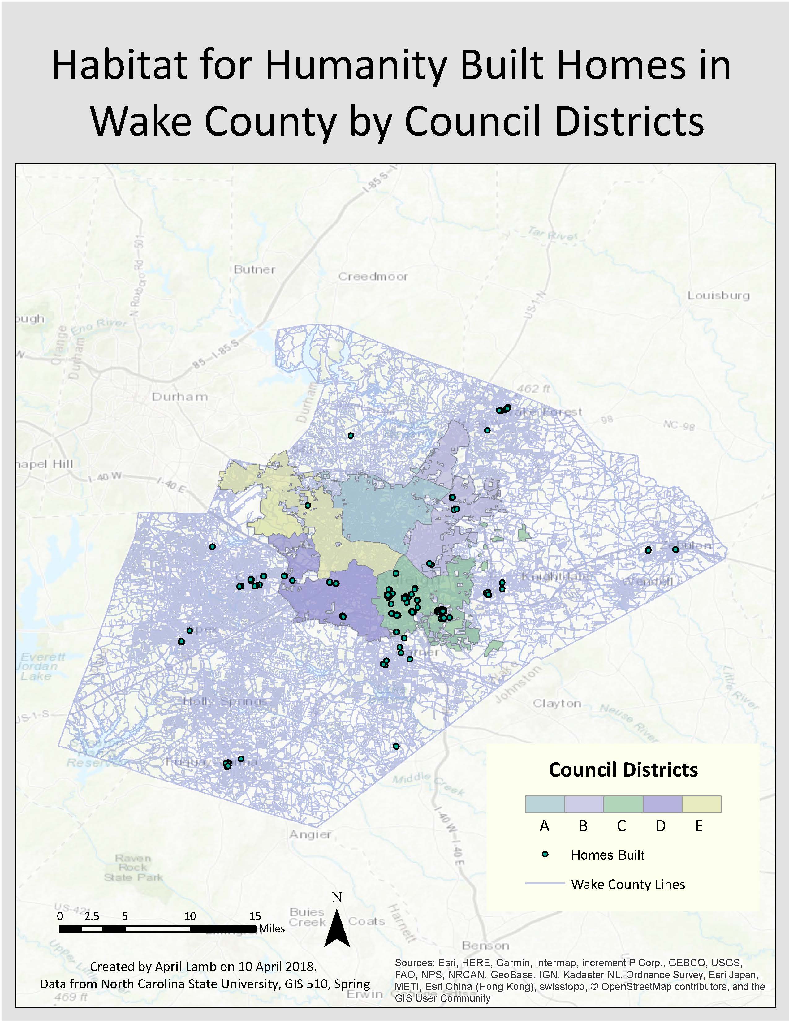
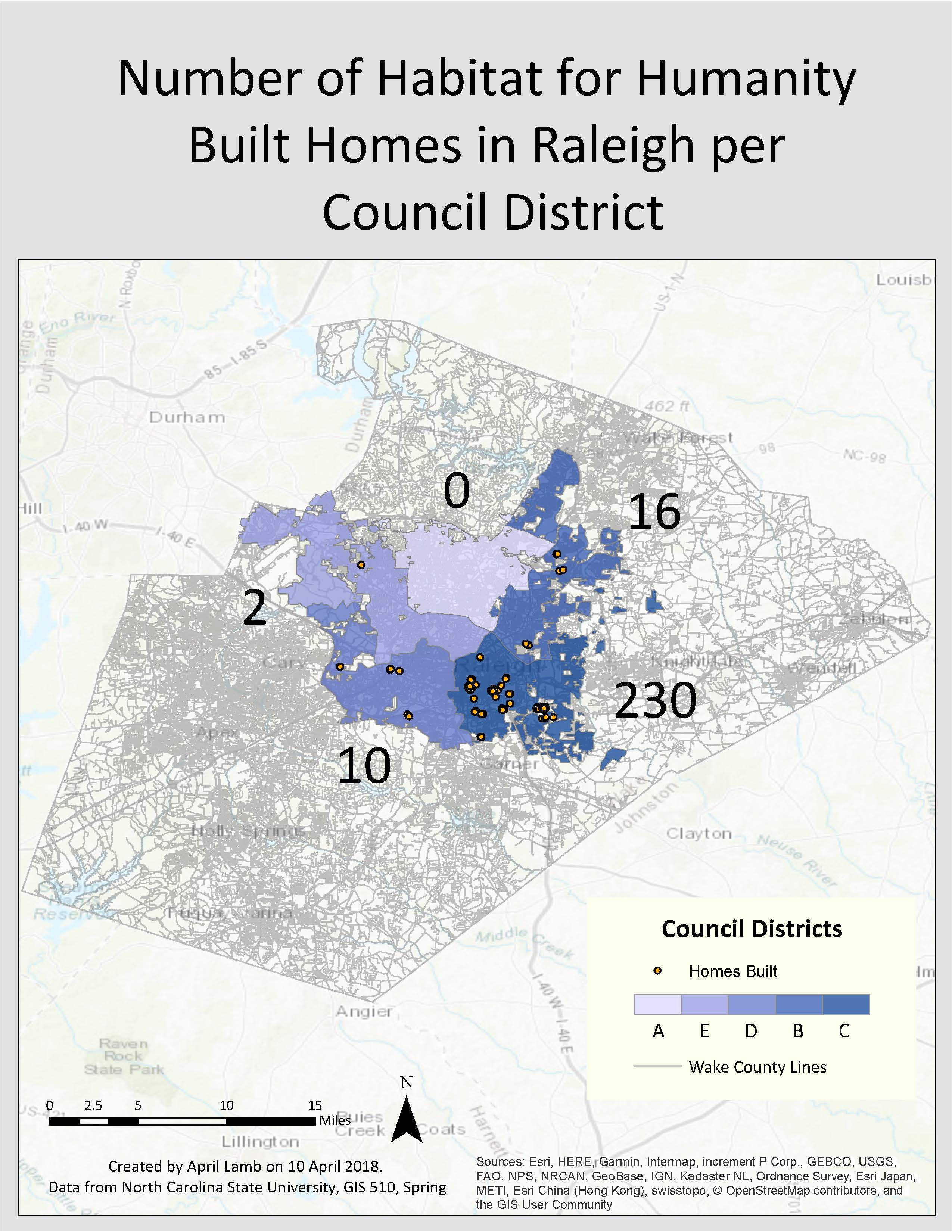
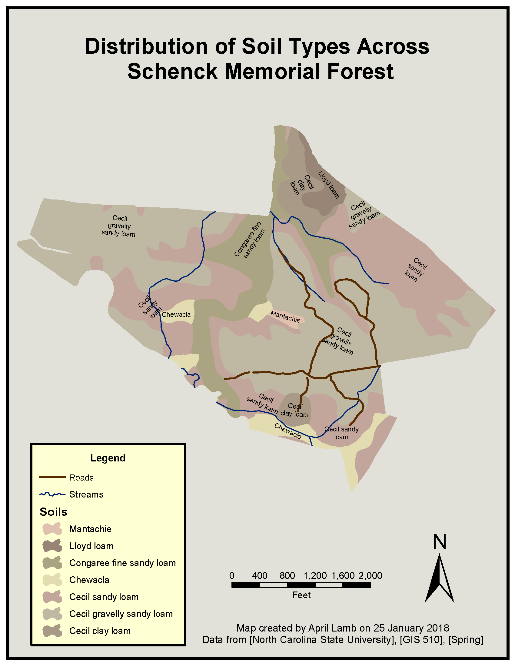
GIS 510: Fundamentals of Geospatial Information Systems
.png)